
How to Utilize GPS on Your Upcoming Backpacking Trip
The Global Positioning System is a navigation technique that uses a network of 24 satellites orbiting the earth to calculate your exact location. On a backpacking trip, GPS can be a useful tool to help you navigate your surroundings. You can access GPS by downloading an app that is designed for outdoor use. The app shows a map with your current location and tracks your movement.
How to Utilize the GPS on a Backpacking Trip
1. Turn on GPS
GPS only works if you turn it on. So, if you’re following the instructions in a backpacking guidebook and recording your route, be sure to turn on the GPS app before you head out.
2. Set Your Location
Setting your location is key to functioning as a GPS unit. If you're trekking in the woods and you don't think about it for a few hours, you might find yourself hundreds of miles away from where you started.
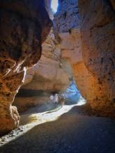
3. Look for Terrain
Once you’re in the backcountry and starting to get your bearings on where you are, check out how the land looks. Look for an outcropping of rocks or trees that you can use to orient yourself. If there’s a creek, identify an identifiable landmark. The same applies if you’re hiking in a city. Find one of the few buildings that look above your head and try to find multiple among streets and parks.
4. Use the Map
Once you’re used to your surroundings, take a moment to look at your map to get an idea of where you are. Learn where all major plants, towns, and roads are located. This will help you find your way back if you get lost.

Basic Functions of GPS Receivers
1. Display Position
The first basic function of a GPS receiver is to display one's current position. The receiver determines its current position using signals transmitted from GPS satellites and then uses that information to generate a map of the surrounding area.
2. Navigate Point-to-Point
GPS receiver navigates a point to a corresponding point. GPS receivers not only show one's current position but also can calculate the route between any two points, using the directions provided by the user in the form of coordinates and length of travel time.
3. Record Tracks
When tracking is turned on, a track is being recorded. The device will then produce a new track file with the time of the last position fix and the number of satellites used in determining that position. This file, along with all other data produced during the exercise, can be reviewed by the user.
4. Navigate Trip Data
GPS can be used to navigate through the trip data. It provides turn-by-turn voice descriptions of where to go if they are enabled. The GPS can also display a map showing the waypoints, track, and other features (such as speed or altitude) that have been previously defined on it. The GPS keeps track of the time, date, and location where each event occurs; in this way, it is like a logbook for a trip.
Advanced GPS Features
1. Electronic Compass
An electronic compass functions as a magnetic compass, but it can display direction digitally. There are no moving parts and the display is easy to read. The digital compass display is accurate in its direction reading for about three degrees of bearing error.
2. Satellites
GPS satellites use their positioning system to know where they are in space. The 24 satellites transmit signals that a GPS receiver can use to establish position.
3. GPS Trackers
A GPS tracker is a small tracking device that uses a GPS receiver to provide information on location and movement. It might be carried by hikers to keep track of their position, or hunters who want to know where their prey is at all times. GPS tracking is also used by companies to track their vehicles via GPS devices.
4. Coordinate Systems
The coordinates of a coordinate system in three-dimensional space are expressed as latitude, longitude, and elevation; these three values define the position of any object on the Earth’s surface.
5. Reminders
Several GPS receivers can automatically generate a reminder to mark the specific point where the user was at a particular time. This is an excellent feature for hikers and backpackers.
Conclusion
Utilizing a GPS device when hiking is a fun and useful way to enjoy the outdoors. It can also be very helpful if an individual is lost. However, users should know how to utilize the GPS properly and be aware of its limitations.

You might also like